
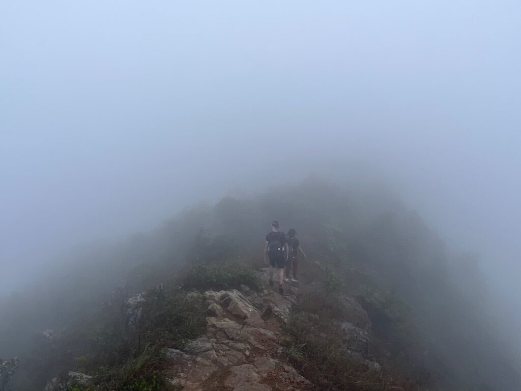
In Spring 2022, we decided to explore the Goose Valley Lost Trail. It was indeed an extreme experience. Not primarily because of the trail: The trail is certainly not easy. But we combined a rather challenging trail with wind, fog and heavy rain, it turned into a challenge. And some even mentioned ice rain or a hail storm. I am uncertain if there are even hailstorms in Hong Kong. However, it felt like one.
How to get there
We started our trek at Ma On Shan MTR. Then we followed the way up to the Goose Valley Lost trail. Initially, we intended to follow the Golden Wall Ridge but decided, due to the weather, to follow the path to the Tiu Shau Ngam North Ridge. In retrospect, this decision may be the wrong one. The Tiu Shau Ngam North Ridge is rated as the more difficult one. Lesson learned.
Below you can find the entire route we took on that day, recorded with my watch.
We did choose to exit down to Ma On Shan Tsuen, via the Hunch Backs and Ma On Shan Peak. The awful weather led to this decision. Once we arrived in Ma On Shan Tsuen, we walked back via Ma On Shan Country Park BBQ site to the Ma On Shan MTR Station.
Details about the hike
Goose Valley Lost Trail (雁谷迷徑) is an excellent route that connects at the end to the Hunch Backs. But there are numerous options to hike this trail, some with challenging elements.
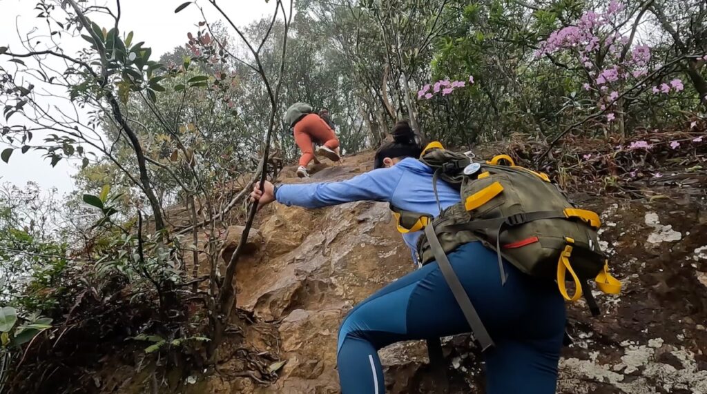
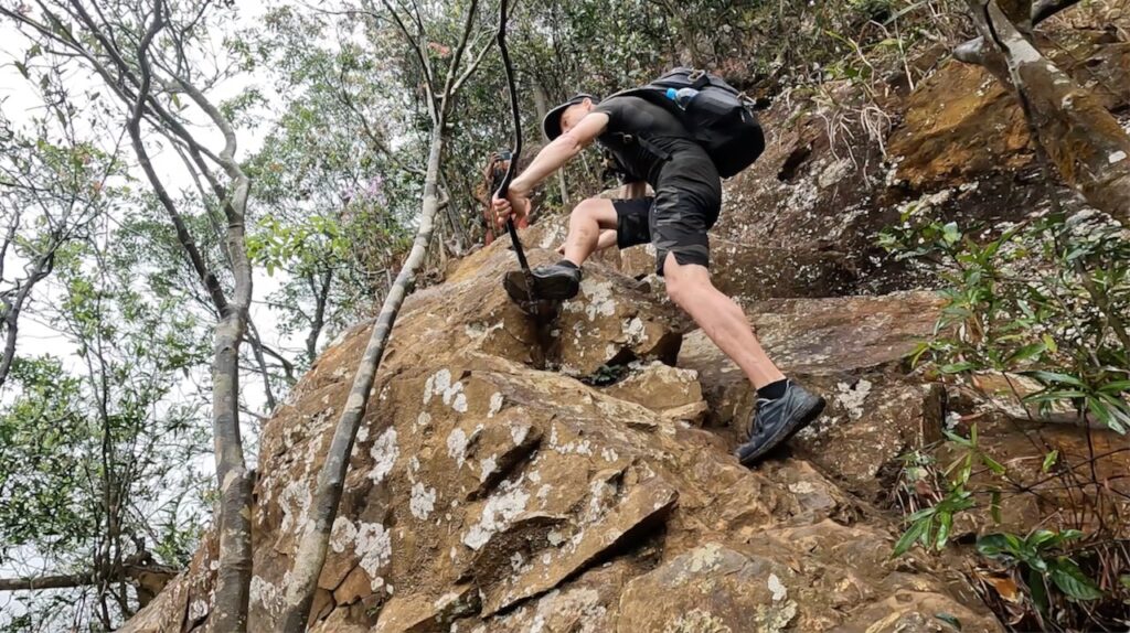
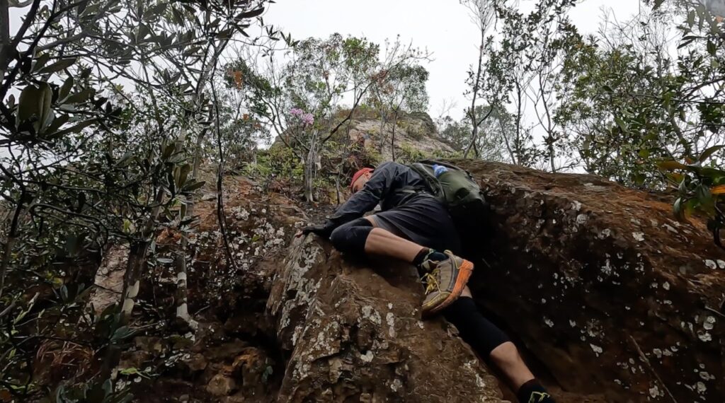
There are also several ridges that you can climb towards Tiu Shau Ngam. In the west, you can find the so-called Golden Wall Ridge (黃金壁脊), which is the easiest. It is steep, and there are exposed cliffs. The easternmost path, known as Tiu Shau North Ridge (吊手北脊) was our choice. Generally, this path is rated more challenging than the Golden Wall Ridge.
On Hong Kong Outdoor Adventures, you can find a pretty great description of the hike. Iurgi did choose a different way, and he had better weather and better views.
Duration and Difficulty
The 10.6 km took us around 6 hours, with an elevation gain of 838 metres. Now, let’s talk about the difficulty of the hike. Well, to give a fair rating, that’s pretty hard. Once you watch my video above, you will understand why. The weather was terrible, which made climbing cliffs pretty hard. I would rate the hike difficulty with a 7/10. Undoubtedly, it was one of the most challenging hikes I did.
Most challenging was for sure the Tiu Shau North Ridge 吊手北脊. There are several tricky situations to conquer. However, the path down to Ma On Shan Tsuen was muddy (but fun). Due to the weather, it was slippery and as well pretty challenging. All over, I enjoyed that hike a lot.
0 comments on “Goose Valley Lost Trail via Tiu Shau Ngam North Ridge”